
The language of “unprecedented weather” has become increasingly common in Southern Africa, yet it often obscures more than it reveals. When heavy rainfall turns into disaster, as it did in KwaZulu-Natal in 2022 and again in parts of the Eastern Cape in 2025, the explanation is frequently framed in climatic terms alone. Extreme rainfall, climate change, atmospheric anomalies—these are the immediate descriptors. They are not incorrect. But they are incomplete.
Because floods do not only arrive with rain. They arrive with infrastructure decisions made over decades, with patterns of settlement that follow uneven opportunity, and with design systems that have struggled to keep pace with how and where people actually live.
In both KwaZulu-Natal and the Eastern Cape, water did not simply overwhelm nature. It overwhelmed systems that were already unevenly prepared to contain it.
Infrastructure as inherited vulnerability
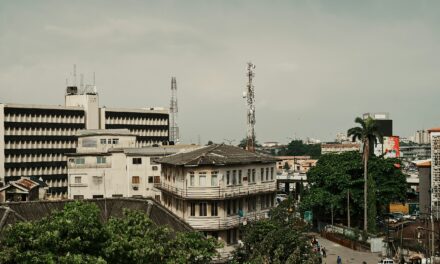
The 2022 floods in KwaZulu-Natal were among the most devastating in South Africa’s recent history, with hundreds of lives lost and thousands displaced. Roads collapsed, bridges failed, and informal and formal settlements alike were exposed to the force of water moving through already vulnerable terrain. According to the South African Weather Service, rainfall levels during the event reached record thresholds in parts of the province, intensifying runoff and saturation across urban and peri-urban zones (https://www.weathersa.co.za/press-releases/2022-kzn-floods-analysis).
But the severity of the disaster cannot be explained by rainfall alone. Much of the damage was concentrated in areas where urban expansion had occurred without sufficient drainage infrastructure, where informal settlements had developed along floodplains, and where steep terrain had been built into without adequate stabilisation systems.
The Eastern Cape floods in 2025 followed a similar pattern. Heavy rainfall events once again exposed gaps in stormwater systems, road maintenance, and spatial planning, particularly in smaller towns where infrastructure investment has lagged behind population needs.
What becomes visible in these moments is not only the power of water, but the unevenness of preparedness. Infrastructure does not fail uniformly; it fails where it has been least reinforced, least updated, and least integrated into the realities of current settlement patterns.
Design that assumes stability
Much of contemporary urban and architectural design is built on an implicit assumption: that environmental conditions are broadly stable, and that infrastructure systems will function consistently over time. Roads are designed with expected rainfall thresholds. Stormwater systems are calculated based on historical weather patterns. Settlements are planned around predictable flows of people, resources, and services.
Climate change disrupts these assumptions, but so does something more immediate: rapid and uneven urbanisation.
In many South African contexts, particularly in provinces like KwaZulu-Natal and the Eastern Cape, urban growth has extended into areas where formal infrastructure has not fully reached. Informal settlements often develop on marginal land—steep slopes, riverbanks, and low-lying zones—not because these areas are ideal, but because they are available.
Design, in these contexts, is often retroactive rather than anticipatory. Infrastructure arrives after settlement, if it arrives at all. Drainage systems are added to environments already shaped by occupation. Roads are upgraded rather than originally planned.
This creates a structural mismatch between how cities are designed and how they evolve. When extreme rainfall occurs, that mismatch becomes visible in the most direct way possible.
Water as a force shaped by the built environment
Flooding is often described as a natural disaster, but in urban environments it is also a design outcome. The way land is surfaced, the way drainage is channelled, and the way settlements are positioned all influence how water behaves when it arrives in large volumes.
In many South African cities, hard surfaces such as concrete and asphalt reduce natural absorption, increasing runoff into already strained drainage systems. Informal settlements, often lacking formal stormwater infrastructure, are particularly exposed. In steep or coastal areas, this combination can accelerate erosion and structural collapse.
The result is not simply excess water, but redirected water—moving through paths shaped by human design decisions over time.
This is why the impact of flooding is so uneven. It does not only reflect the volume of rainfall; it reflects the distribution of infrastructure. Some areas absorb and channel water effectively. Others do not. The difference is not meteorological. It is spatial.
The infrastructure gap beneath the surface
Across Sub-Saharan Africa, infrastructure deficits remain a persistent constraint on urban resilience. The African Development Bank estimates that the continent faces an annual infrastructure financing gap of over $100 billion, affecting transport, water, and energy systems (https://www.afdb.org/en/topics-and-sectors/initiatives-partnerships/infrastructure-development).
This gap is not abstract in moments of crisis. It manifests in blocked drainage systems, insufficient stormwater capacity, and limited maintenance of existing urban infrastructure. In many cases, systems exist but are not updated to reflect current climate realities or population density.
South Africa, while more developed than many regional counterparts, still reflects this challenge in uneven ways. Well-serviced urban cores often exist alongside under-resourced peripheries, creating a fragmented infrastructure landscape within the same metropolitan areas.
When extreme weather events occur, this fragmentation determines outcomes as much as rainfall intensity does.
Rethinking design beyond aesthetics
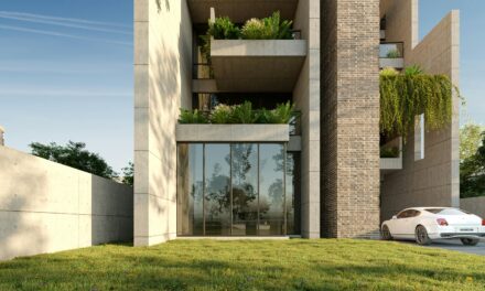
In discussions about sustainable design, attention is often directed toward buildings: their materials, their energy use, their visual integration with the environment. These elements matter, but they do not address the broader systems that determine resilience at scale.
Flood events in KwaZulu-Natal and the Eastern Cape highlight a different design question. Not how individual buildings perform, but how entire urban systems absorb, redirect, or fail under environmental stress.
This shifts the focus from architecture to infrastructure: roads, bridges, drainage networks, and settlement patterns. It also shifts the time horizon of design from the moment of construction to decades of adaptation.
A well-designed building cannot compensate for a collapsed bridge network. A green-certified development cannot prevent flooding if it is embedded within a poorly drained catchment area. Sustainability, in this sense, is not a feature of isolated structures but a property of interconnected systems.
Living with instability rather than designing around it
One of the underlying assumptions in much urban planning is that instability can be designed out of the system. That better materials, smarter layouts, and more efficient infrastructure will reduce vulnerability to external shocks.
But in climates that are increasingly variable, and in cities that are expanding rapidly, instability is not an exception. It is part of the operating environment.
This does not mean that design is powerless. It means that its focus must shift. Instead of attempting to eliminate uncertainty, infrastructure design may need to prioritise adaptability: systems that can absorb variability, settlements that can adjust over time, and urban forms that acknowledge rather than resist environmental dynamics.
In this framing, resilience is not about permanence. It is about responsiveness.
Beyond the event
The floods in KwaZulu-Natal in 2022 and the Eastern Cape in 2025 will likely be remembered as discrete disasters, each tied to specific weather systems and moments in time. But their deeper significance lies in what they reveal about the relationship between design and environment.
They show that infrastructure is not neutral. It shapes risk as much as it mitigates it. They show that urban form is not static. It interacts continuously with water, terrain, and climate. And they show that sustainability cannot be meaningfully separated from the systems that carry it.
In the end, the question is not only how to design against flooding. It is how to design with the understanding that water, like cities themselves, will not remain within the boundaries we set for it.